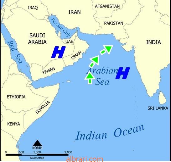
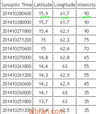
As of Tuesday morning, EDT, Tropical Cyclone Nilofar is located approximately 375 miles south-southeast of Masirah Island. Nilofar is moving north-northwest at about 7 mph. Maximum sustained winds are near 105 mph with gusts to 125 mph.
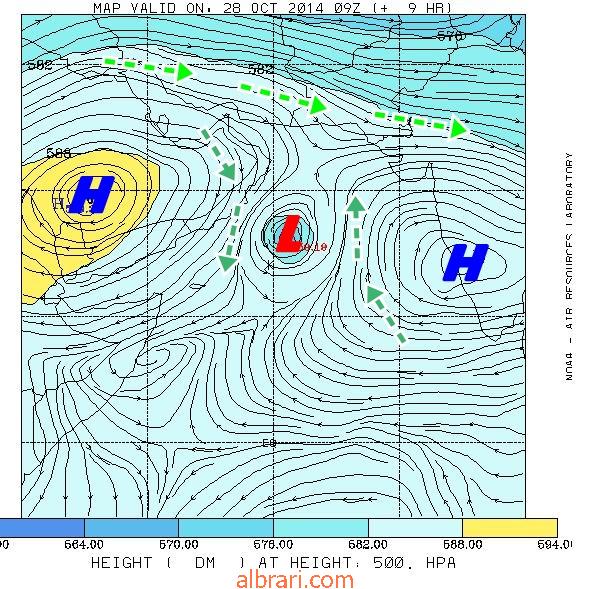
Latest satellite imagery shows deep convective banding around Nilofar's center due to low vertical wind shear and warm sea surface temperatures. As a result, further strengthening is expected through late Tuesday with some increase speed towards the northwest and the north.
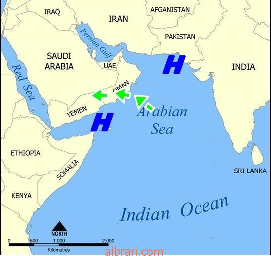
Nilofar will bring high surf along the eastern coast of Oman Wednesday into Thursday before veering towards the northeast with an increase in forward speed. Some rain is also possible along the coast of Oman.
Nilofar is forecast to make landfall in western India late this week or early this weekend, in Kutch or the Kathiawar Peninsula, and may bring life-threatening flooding and the potential for damaging winds to the region.
Story by AccuWeather.com Meteorologist John Schneider
اخر توقعات الخبير جون شنايدر ولب وزبدة الكلام
يقول شنايدر ان نيلوفار مازال يتحرك بمسار شمال غرب ومع مساء اليوم
يتحرك شمالاً حتى يقترب من سلطنة عمان
مع توقعات ارتفاع عالي للامواج واضطرابات بالرياح الشديدة
على سواحل جنوب شرق سلطنة عمان
ومع يوم غداً ينحرف ليسلك مسار شمال شرق بتجاه سواحل الهند
واردف يقول شنايدر انه متوقع ان يسبب نيلوفار امطار فيضانية وكوارث على سواحل الهند اواخر هذا الاسبوع .


 2014-10-28, 11:10 AM


 العرض العادي

